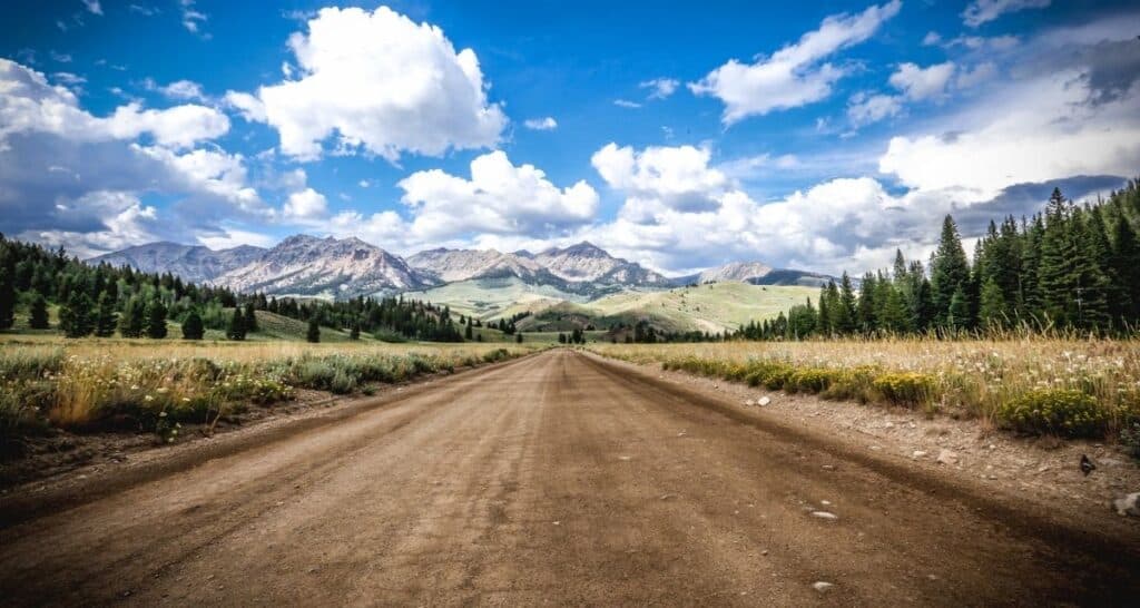
With a state so rich with natural beauty its no wonder why Idaho Scenic Byways are some of the finest drives in the country. From the lakes and rivers to ghost towns and jagged peaks, no Idaho road trip would be complete without tackling these stunning byways and scenic drives in Idaho.
The byways are grouped into three regions and there’s an interactive map at the beginning of each region:
(you can click below to jump to a particular region)
1. Northern Idaho Scenic Byways
2. Eastern Idaho Scenic Byways
3. West and Central Idaho Scenic Byways
Northern Idaho Scenic Byways
Northern Idaho is home to tree-covered mountains and beautiful lakes, including Priest Lake, Lake Pend Oreille, and Lake Coeur d’Alene. It also features exciting activities such as ski resorts, theme parks, and hundreds of miles of bike trails. Northern Idaho’s panhandle offers excitement with a variety of state parks and scenic byways.
With sharp ridges and historic mountain towns nestled in picturesque valleys, the region is characterized by mountaintop lakes formed by jagged peaks and ancient ancient glaciers. Big, winding rivers full of trout and lazy streams where moose munch on the grasses.
The interactive map below lets you click on the routes, zoom in and out, and if you select the square box in the upper corner you can toggle on and off the different scenic byway routes.
Elk River Backcountry Byway
This 57 mile route takes you through the rural North Central Idaho mountains for a no frills adventure the whole family can enjoy. You’ll quickly enter a vast forested landscape that draws you in deeper as you chase the Clearwater Mountain range on your horizon.
The trip starts in Orofino with a climb up and along Wells Bench, which is dotted with ranchettes and farmsteads among the benches between timber patches. You’ll then descend as the forest gets thicker, crossing Dent Bridge, a suspension bridge that connects Clearwater County to the woodland oasis that once fueled the area’s economy.
Along the route, you’ll find a variety of animals, including black bears, bobcats, cougars, deer, elk, osprey, songbirds, wild turkeys, and maybe even wolves. Elk River is a charming town located 34 miles from Orofino that has made a complete circle: It began as a remote hunting and recreation camp built by Potlatch as a mill town (site of the world’s first electric-powered mill), only to return to a recreational community in the twenty-first century.
Route
Begins in Orofino at Idaho 7 and Wells Bench Road, head North and cross North Fork of the Clearwater at Dent Bridge, then to Elk River where it joins Idaho 8 to Bovill.
Length
57 miles. Allow 2 hours one way.
Road condition
Wells Bench is a two-lane county road paved to one mile beyond Dent Bridge; from there the road surface is gravel; at Elk River the roadway is again a paved two lane road with slow vehicle turnouts. The route is well maintained year round but can be icy in winter.
Best time to go
Throughout the year. Summer offers camping, boating, fishing and hiking. Winter provides over 300 miles of snowmobiling and 20 miles of regularly groomed ski trails.
Attractions along the way
City of Orofino; Dent Bridge; Scenic Viewpoint – Confluence of Elk Creek and North Fork Clearwater River (Dworshak Reservoir); Loop Road to USFS Campground & town; Mill Pond & Mill Site; Clearwater Potlatch Timber Protective Association; Elk River downtown; Elk River Historical Museum; Giant Western Redcedar & Morris Cedar Grove; Elk Creek Falls; City of Bovill.
Camping
Multiple RV Parks in Orofino; campgrounds along Dworshak Reservoir (Canyon Creek & Dent); Elk River has 64 camping sites along Elk Creek Pond, 23 improved sites at the Forest Service campground, and a RV Park with 24 sites; RV Park with 15 sites in Bovill. The forest lands along the byway are open to off road unimproved camping so visitors can choose their own spot off the beaten path.
Services
Full services in Orofino and Elk River; partial services in Bovill.
More info
Elk River Lodge & General Store: 208-826-3299 or www.elkriverlodge.net; and Orofino Chamber of Commerce: 208-476-4335 or www.orofino.com; www.northcentralidaho.info, 1-877-DO-IDAHO
Gold Rush Historic Byway
The drive along Idaho 11 in Northern Idaho begins in Greer at the junction of US 12 and an easy climb up the Greer Grade, which offers a spectacular panoramic view of the Clearwater Valley. The lovely rolling fields of grains and grasses tended by local farmers are found at the top of the hill. Weippe is a historic town located not far from where members of the Nez Perce tribe fed starving members of Lewis and Clark’s Corps of Discovery in 1805.
The byway passes through lush forests, which give way to a small town of Pierce. The region’s first gold was discovered here by pioneers in 1864. It also features the state’s first government building, the old Shoshone County Courthouse, which opened in 1864. A logging museum and a collection of artifacts from Chinese miners’ exploits in the area are among other things to see.
The village of Headquarters, twelve miles north of Pierce, marks the conclusion of the Gold Rush Historic Byway and the beginning of the region’s other “gold mine” – The magnificent Clearwater National Forest.
Route
Begins at the junction of U.S. 12 and Idaho 11 on the Clearwater River at Greer.
Length
42.5 miles. Allow 2.5 hours round trip.
Road condition
Idaho 11 is a two-lane, paved road with some passing lanes. It is well maintained with several turnouts for scenic viewing. It can be icy during winter months.
Best time to go
Throughout the year. Summer offers camping, fishing, riding, and hiking areas. Winter provides skiing and snowmobiling on 350 miles of groomed and open trails, maintained weekly.
Attractions along the way
Lewis and Clark historical sites; Weippe Discovery Center; Idaho’s first county courthouse; Bradbury Logging Museum; Pierce City Library and historic downtown area; a Chinese cemetery; Bald Mountain Ski Area; and the Clearwater National Forest.
Camping
Three RV parks in Pierce, two in Weippe; campgrounds in Fraser Park and both Hollywood and Campbell’s Pond. There are many camping areas in the surrounding Clearwater National Forest and the North Fork of the Clearwater River recreational area.
Services
Full services in Weippe and Pierce; partial services in Greer. Headquarters has no services.
More info
Pierce-Weippe Chamber of Commerce/Weippe Discovery Center: 208-435- 4406, www.weippe.com; www.northcentralidaho.info, 877-DO-IDAHO; City of Pierce: 208-464-2222,www.ohwy.com/id/p/pierce.htm; City of Weippe: 208-435-4216 www.weippe.com.
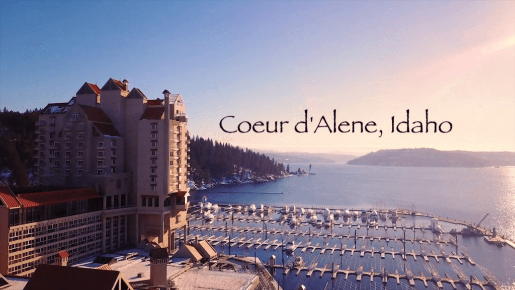
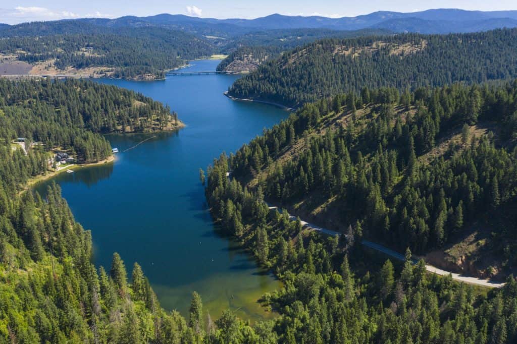
Lake Coeur d’Alene Scenic Byway
The Lake Coeur d’Alene Scenic Byway passes through a region that has made it one of the most popular summer vacation areas and resort destinations in the Pacific Northwest, thanks to its beautiful lakes, mountains, and ideal summer weather. It also contains a variety of wildlife, including moose, deer, elk, bear, and several bird species that still frequent the untouched forests of northern Idaho.
From the junction of Interstate 90 and Idaho 97, the trip goes south along the Lake Coeur d’Alene shoreline, home to bald eagles and the Western states’ greatest number of nesting ospreys. Don’t miss the Mineral Ridge Trail with its panoramic views of the lake as well as several learning stations about the region’s flora and fauna.
Route
Begins at the junction of Interstate 90 and Idaho 97 and follows Idaho 97 south and east along Lake Coeur d’Alene to Idaho 3.
Length
35.8 miles. Allow 1 . 5 hours.
Road condition
Idaho 97 is a two-lane, paved winding road with few passing lanes .
Best time to go
Throughout the year. Eagle watching is great in December and January between Wolf Lodge Bay and Beauty Bay.
Attractions along the way
Lake Coeur d’Alene; Mineral Ridge Trail at Beauty Bay; Historic Harrison; Thompson Lake Wildlife Refuge; Trail of the Coeur d’Alenes.
Camping
Beauty Creek east of Beauty Bay, Bell Bay near Harrison, city of Harrison .
Services
Partial services in Carlin Bay, Squaw Bay, and Harrison. Full Services in Coeur d’Alene.
More info
Coeur d’Alene Area Chamber of Commerce: 208-664-3194 or 877-782-9232, [email protected], www.coeurdalene.org; St. Maries Chamber of Commerce: 208-245-3563, www.stmarieschamber.org
Northwest Passage Scenic Byway
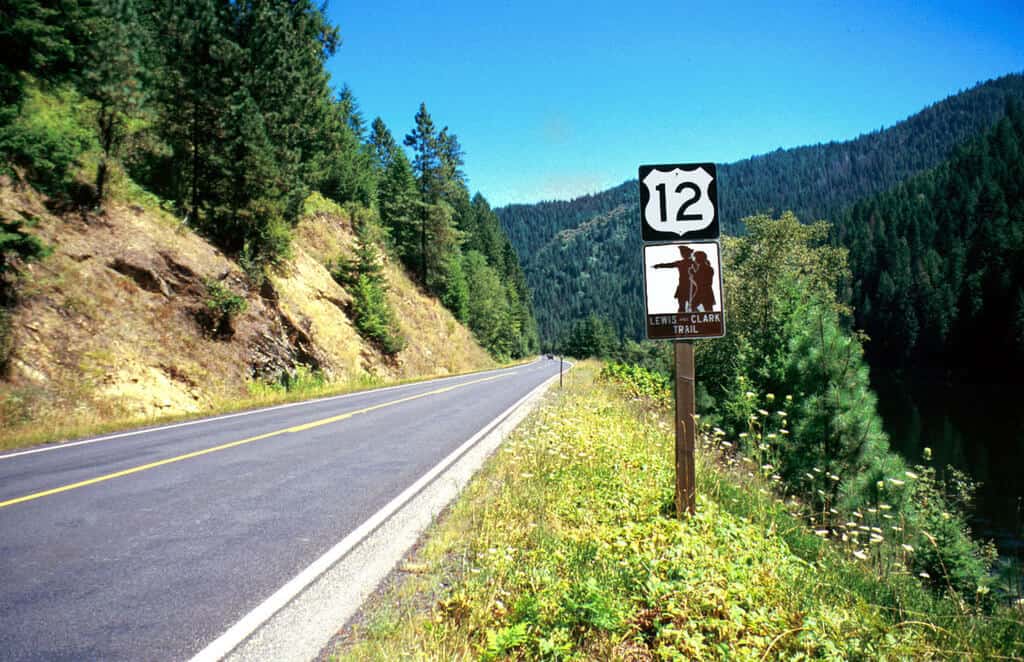
In 1803, President Thomas Jefferson charged Meriwether Lewis and William Clark with finding the Northwest Passage, a route connecting the Missouri River to the Columbia River across uncharted Rocky Mountains. This 202-mile scenic byway skirts along the explorers’ path through Nez Perce country in north-central Idaho.
The beautiful journey from the west begins on US-12 in Lewiston and travels along the twisting Clearwater River Canyon, passing through Spalding and Kamiah in the Nez Perce National Historical Park. At Kamiah is Heart of the Monster, a geologic formation and legendary Nez Perce site.
There is a fork in the Northwest Passage Byway at Kooskia. One path heads south on Idaho State Highway 13 to Camas Prairie and the town of Grangeville, while the other route travels east along US 12 along the Middle Fork of the Clearwater River, passing through a lovely natural environment culminating at the Lolo Pass Visitor Center.
Route
Begins in Lewiston and follows U.S. 12 northeast to the Idaho-Montana border; also follows Idaho 13 from Kooskia to Grangeville and the junction of U.S. 95.
Length
202 miles. Lewiston to Montana, 175 miles, allow 4 hours. Kooskia to Grangeville, 27 miles, allow 40 minutes.
Road condition
Idaho 13 and U.S. 12 are winding, two-lane, paved roads with occasional passing lanes and slow vehicle turnouts. Winter driving conditions may include black ice in the canyons and snow-covered roads at higher elevations.
Best time to go
Boating, fishing, heritage sites, and wildlife viewing year-round. Whitewater opportunities in spring and summer.
Attractions along the way
U.S. 12 parallels the Lewis & Clark and Nez Perce national historic trails. Sites include Tsceminicum sculpture, Lewiston; Nez Perce National Historical Park Visitor Center, Spalding; Canoe Camp, Orofino; Heart of the Monster, Kamiah; Kooskia Crossing; mammoth exhibi Grangeville; Fenn & Lochsa historic ranger stations; DeVoto Grove; Lalo Pass Visitor Center; Hells Gate and Dworshak State Parks.
Camping
Campgrounds at Lewiston, Myrtle, Orofino, Kamiah, Kooskia, Grangeville, and Lowell. Forest Service and BLM campsites along the Clearwater and Lochsa rivers.
Services
Full services in Lewiston, Orofino, Kamiah, Kooskia, Grangeville; partial services at Stites, Syringa, Lowell, and Powell. Rest areas at Lenore and Lalo Pass.
More info
North Central Idaho Travel Association 877-364-3246 or www.northcentralidaho.info; Nez Perce National Historical Park 208-843-700 I or www.nps.gov/nepe; Chambers of Commerce: Lewiston 208-743-3531; Orofino 208-476-4335, orofino.com; Kamiah 208-935-2290, kamiahchamber.com; Kooskia 208-926-4362, kooskia.com; Grangeville 208-983-0460; Clearwater National Forest 208- 476-454 I; Nez Perce National Forest 208-983-1950; Nez Perce Tribe 208-746-0723 or www.nezperce.org.
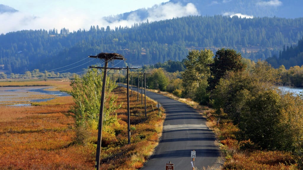
Panhandle Historic Rivers Passage
The Panhandle Historic Rivers Passage begins at the Washington border and follows the northern shore of the Pend Oreille River to Oldtown, Priest River, and Sandpoint. This byway is the western section of the International Selkirk Loop, which continues into Washington on the west and goes into British Columbia on the Wild Horse Trail Scenic Byway from Sandpoint on the east.
Drive through miles of beautiful scenery that pays tribute to the rural splendor of surrounding forests and farms. Stop and be delighted by various seasonal wildlife, as well as birds of prey and waterfowl; or pull off the road and learn about northern Idaho’s history at three museums along the route.
The area’s attractions range from extraordinary scenery to sophisticated museums, golf courses and world-class resorts. The local history dates back to the Ice Age and the Great Missoula Floods. Convenient access to four recreation areas on the Pend Oreille River allow you to swim or boat along large, gently flowing bodies of water. Winter activities include snow sports, ice fishing and downhill skiing at Schweitzer.
Route
Begins at the Washington state line and follows U.S. 2 to Sandpoint.
Length
28.5 miles. Allow 40 minutes.
Road condition
U.S. 2 is a two-lane, paved road with no passing lanes . It can be icy during winter months. U.S. 12 is a winding, two-lane, paved roads with occasional passing lanes and slow vehicle turnouts. Winter driving conditions may include black ice in the canyons and snow-covered roads at higher elevations.
Best time to go
Throughout the year. Eagles in the winter, osprey in the summer, waterfowl in the spring and fall. Nature’s palette of vegetation colors are particularly abundant in spring and fall.
Attractions along the way
Pend Oreille and Priest Rivers; Panhandle National Fores Seneacquoteen Interpretive Site; Rotary Park in Oldtown; Priest River Wildlife Area; Albeni Falls Dam Visitor Center; three historical museums; and Priest River’s historic downtown.
Camping
“Mudhole” Recreation Area at Priest River and Riley Creek Recreation Area eight miles further west at Laclede; numerous other camping sites within area including beautiful Priest Lake.
Services
Full services in Priest River, Sandpoint, and Oldtown/Newport.
More info
Priest River Chamber of Commerce: VisitorsCenter: 208-437-3133; Ranger Station in Sandpoint: 208-263-5111; Ranger Station at Priest Lake: 208-443-2562; International Selkirk Loop: 888-823-2626, www.selkirkloop.org.
Pend Oreille Scenic Byway
The Pend Oreille (pon-der-ay) Scenic Byway is full of stunning water views. Beginning at the junction of U.S. 95 and Idaho 200, Idaho 200 meanders eastward to the Montana state line across agricultural fields, river deltas, and rocky northern shores of Lake Pend Oreille, all carved by the tremendous power of glaciers and Glacial Lake Missoula’s floodwaters. Pullouts along the route provide visitors with opportunities to stop and take in breathtaking views of mountainous horizons that frame miles of open water.
The lake’s shores offer four-season recreational choices that extend across the vast regions of national forest overlooking the Pend Oreille Scenic Byway. Whether you want to swim, fish, boat, golf, hunt, hike, bird watch, alpine ski, water ski or snowmobile – each of the four distinct seasons has an exceptional recreational activity for almost everyone who enjoys the outdoors.
Visiting the lake offers visitors a wide range of choices, ranging from unimproved mountain campsites to well-maintained shoreline campgrounds to recreational vehicle parks on the water to lakefront hotels and motels.
Route
Begins at U.S. 95 north of Sandpoint and follows Idaho 200 to the Montana state line.
Length
33.4m iles. Allow 1.5 hours to enjoy the scenery and interpretive information.
Road condition
Idaho 200 is a two-lane, paved road with no passing lanes, but numerous scenic turnouts . Winter driving conditions can vary drastically so it’s advised to check the weather.
Best time to go
Throughout the year. Winter scenes can be magnificent, spring and fall colors are dramatic.
Attractions along the way
Lake Pend Oreille; Clark Fork River and delta; roadside interpretive exhibits; Schweitzer Ski Area; Panhandle National Forests’ seasonal trails and roads; and four seasons of recreational opportunities.
Camping
Samowen Campground on the lake, maintained and primitive spots in the Panhandle National Forest, and numerous private spots in the area.
Services
Full services in Clark Fork, Ponderay, and Sandpoint; partial services in Hope.
More info
Hope-Clark Fork Chamber of Commerce: 208-266-1552, www.pobyway.org, [email protected]; Sandpoint Chamber of Commerce: 800-800-2106; Sandpoint Ranger District: 208-263 -5111.
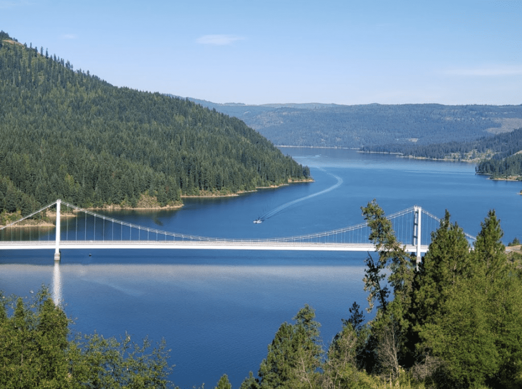
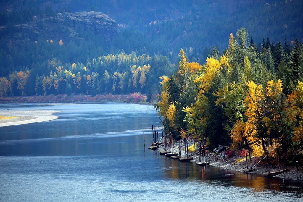
St. Joe River Scenic Byway
At the town of St. Maries, which is home to the Logger Memorial, your trip begins. You travel east along the shadowy St. Joe River so named for the towering Cottonwoods that line its banks. Bald eagles and ospreys utilize the trees as nesting sites and perches where they launch themselves to pick food from “The Joe’s” forest banquet table. The river is deep and still with breathtaking mountain vistas captured on its watery surface as you travel this Idaho scenic byway.
At St. Joe City, The Joe transitions into one of Idaho’s finest blue ribbon trout fisheries. As the water gets clearer and shallower you can even see the Dolly Vardens, Rainbow, and cutthroat trout.
The interpretive center’s logging exhibit at Marble Creek is a must-see. Visit the trout pond in Avery, where rainbow trout rise to your bait. The historic train depot and refurbished sleeper/dining car are also worth seeing. Deer, elk, moose, and bear may be observed along the river’s edge, as you make your way along the St. Joe River Scenic Byway.
Route
From St. Maries at the junction of Idaho 3 and Forest Hwy 50 (FS 50), east along the St. Joe River for 75m iles. At the junction with Road 218, FS 50 heads north (left) and climbs 14 miles to the Idaho-Montana border.
Length
89 miles. Allow 2.5 to 3 hours one way.
Road condition
Two-lane, paved road with numerous pull-outs and points of interest along the way.
Best time to go
Throughout the year from St. Maries to Avery (47 m iles). The 42 miles from Avery to the Idaho border is usually open from May through November. During the winter, this section is a snowmobile route.
Attractions along the way
Falls Creek waterfall; Marble Creek historic site and picnic area; Avery Ranger Station; Avery Museum; Upper Landing Picnic area; Idaho Panhandle National Forest; St. Joe Wild and Scenic River; breathtaking scenery; blue ribbon fishery; white water rafting; and the Hiawatha Rails to Trails is near by.
Camping
Private facilities are available in and around St. Maries and Avery; Shadowy St. Joe Campground and Huckleberry Campground are located along the lower, slower moving St. Joe River; Pack Saddle; Turner Tin Can and Conrad Crossings campgrounds are upstream from Avery along the Wild and Scenic St. Joe; and numerous undeveloped campsites along the river.
Services
Full services are available in St Maries and Avery, and partial services in Calder.
More info
St. Maries Chamber of Commerce: 208-245-3563, www.stmarieschamber.org; St. Joe Ranger District, St. Maries Office : 208-245-2531, Avery Office:208-245-451 7, www.fs.fed.us; Bureau of Land Management: www.blm.gov.
White Pine Scenic Byway
The White Pine Scenic Byway begins at Interstate 90 on the outskirts of Cataldo, where the Old Mission of the Sacred Heart is located. The mission, which was built in the mid-1800s, is Idaho’s oldest remaining structure; visitors can also tour the Parish House and two historic cemeteries on the grounds, as well as explore the visitor center, walking trails, and picnic areas
The beautiful White Pine Scenic Byway travels through the state’s lush forests of pine and other trees to Idaho’s timber country and numerous lakes and marshes on its way from Cataldo to St. Maries, passing by the historic Hughes House Museum and other attractions. The route then crosses the stunning St. Maries River before reaching the towering St. Joe River, which is the world’s highest navigable river.
The byway continues on Idaho 6 south through Emida, where it passes through the St. Joe National Forest and has the largest White Pine stand in the United States. The route meanders along rolling hills in Washington’s Palouse region to ancient Potlatch, once home to the world’s largest white pine lumber mill.
Route
From the junction of Interstate 90 and Idaho 3, south on Idaho 3 to Idaho 6, then southwest to U.S. 95 at Potlatch .
Length
82.8 miles. Allow 2 hours.
Road condition
Idaho 3 and Idaho 6 are both two-lane, paved roads with no passing lanes .
Best time to go
Throughout the year.
Attractions along the way
Old Mission State Park; Coeur d’Alene River Wildlife Management Area; St. Joe National forest; Palouse Divide Nordic Ski Area (“Park and Ski” cross country area); Trail of the Coeur d’Alenes; Potlatch historic walking tours; Mullan Trail Park, Steam Donkey, 1910 fire Memorial and historical murals in St. Maries.
Camping
Laird Park, Giant White Pine Park north of Harvard, Pines RV and Camping in Harvard; Scenic 6 RV Park in Potlatch; Heyburn State Park, Benewah County fairgrounds, Shady River RV Park in or near St. Maries.
Services
Full services in St. Maries; partial services in Potlatch.
More info
St. Maries Chamber of Commerce: 208-245-3563, www.stmarieschamber.org; Idaho Panhandle National forest: 208-245-2531; Old Mission State Park: 208-682-3814; Potlatch City Hall: 208-875-0708, potlatchidaho.org; Coeur d’ Alene Area Chamber of Commerce: 208-664-3194 or 877-782-9232, [email protected], www.coeurdalene.org.
Wild Horse Trail Scenic Byway
The International Selkirk Loop, which includes the Wild Horse Trail Scenic Byway, is North America’s only international scenic byway. The route begins in Sandpoint on Lake Pend Oreille’s northwestern shores and heads north along the eastern slope of the Selkirk Mountains. The road travels up the Kootenai Indian tribe’s ancient approach to fishing areas at Lake Pend Oreille as it follows the eastern border of the Selkirk Mountains.
The “Wild Horse Trail” was used by David Thompson, the first white explorer, in 1808. In 1863, when gold was found in Wild Horse Creek 120 miles to the north of Bonners Ferry Idaho, it became more than a trail. The “Wild Horse Trail” was used extensively during the gold rush until around 1880.
The arrival of the Northern Pacific Railroad to this region resulted in David Thompson’s old route becoming a major freight line for the railway. Just south of Bonners Ferry, an astounding spacious glacier valley comes into view. Rich soil deposits formed by retreating glaciers left nutrient-rich soils that still support a wide range of agriculture throughout the Kootenai Valley today.
The Kootenai National Wildlife Refuge and the McArthur Lake Wildlife Management Area west of Bonnen Ferry provide a wealth of recreational activities, including wildlife viewing, bird watching, and hiking trails. There are six major entrance roads into the Selkirk Mountains that lead onto Panhandle National Forestlands, where hikers, anglers, campers, Nordic skiers, and snowmobilers can go enjoy their leisure time.
Route
Begins on U.S. 95 in downtown Sandpoint and follows U.S. 95 north through Bonners Ferry to the junction of U.S. 95 and Idaho 1, then proceeds north on Idaho 1 to the International Border at Porthill.
Length
48.2 miles from Sandpoint to junction of U.S. 95/ldaho I, 11 miles to the International Border at Porthill. Allow 1.5 hours.
Road condition
U.S. 95 is predominantly a two-lane, paved road with 4 lanes starting 2 miles north of Sandpoint for 5 miles. There are multiple passing lanes along the route.
Best time to go
Throughout the year. Four full, distinct seasons with activities and events available every month. Fall colors are especially dramatic.
Attractions along the way
Lake Pend Oreille; Kootenai National Wildlife Refuge; Panhandle National Forest; McArthur Lake Wildlife Corridor; Kootenai Sturgeon Hatchery; Historic Bonners Ferry and Kootenai River.
Camping
Privately owned campgrounds in and around Sandpoint and Bonners Ferry. Camping at Smith Lake, 5 miles north of Bonners Ferry, seven sites, no fee. Other camping near by at Meadow Creek, Robinson Lake, Copper Creek and Samowen.
Services
Full services in Sandpoint and Bonners Ferry.
More info
Sandpoint Visitor Center: 800-800-2106; Greater Sandpoint Chamber of Commerce: 208- 263-0887, www.sandpointchamber.org; Greater Bonners Ferry Chamber of Commerce & Visitor Center: 208-267- 5922, www.bonnmferrychamber.com; International Selkirk Loop: 888-823-2626, www.selkirkloop.org; Sandpoint Ranger District: 208-263-5111; Bonners Ferry Ranger District: 208-267-5561, www.fs.fed.us/ipnf; US Customs at Porthill: 208-267-5309; Idaho Department of Lands: 208-267-5577 or 208-263-5104.
A Plethora of Scenic Drives In Idaho
There’s no shortage of scenic drives in Idaho and we’ve only scratched the surface. Unlike many other states you won’t be bombarded by crowds while exploring Idaho’s scenic byways. Take your time exploring these drives on your next road trip, the slower you go the more you’ll see.
Combine your adventurous Idaho road trip with these other unique destinations:
11 Idaho Ghost Towns You’ll Never Forget
10 Ohhh So Good Hot Springs Near Boise
11 FUN Things To Do In Coeur d’Alene With Kids