Southern Idaho is best explored as a set of regional trips rather than one long checklist: base in Twin Falls for Snake River Canyon and waterfall stops, choose Hagerman for springs and fossil history, or plan a separate outing to City of Rocks or Craters of the Moon. These landscapes belong to the same broad southern Idaho story, but they are not all next door to one another.
For a first trip, choose one base and two or three main stops. Our statewide Idaho things-to-do guide is useful for the big picture; this guide concentrates on the Magic Valley and nearby destinations that reward a more deliberate road-trip route.
Where is southern Idaho?
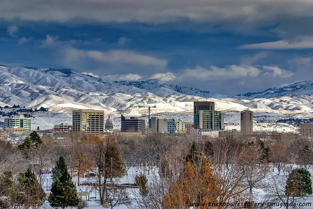
“Southern Idaho” can mean the whole lower portion of the state in everyday conversation, including the Boise area to the west and Pocatello farther east. In regional tourism planning, Visit Southern Idaho concentrates on south-central Idaho: the Magic Valley, Snake River Canyon and communities around Twin Falls, Jerome, Hagerman, Burley and Rupert.
That distinction matters when booking a place to stay. A hotel described only as being in south Idaho may be nowhere near the attraction on your list. Start with an actual town and map the day’s stops from there. Our Twin Falls town guide is a useful base-planning companion; use a different overnight location if your trip is mainly about another part of the state.
Twin Falls: start with the canyon, not a driving marathon
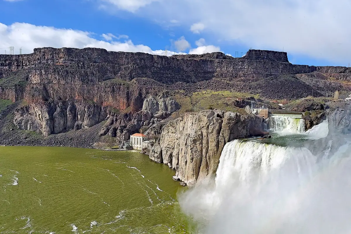
Twin Falls puts the Snake River Canyon at the center of the day. Begin with the rim and the Perrine Bridge area, then decide whether to devote the afternoon to another canyon viewpoint or to Shoshone Falls. This is a better first-day plan than racing between several distant landscapes after a long arrival drive.
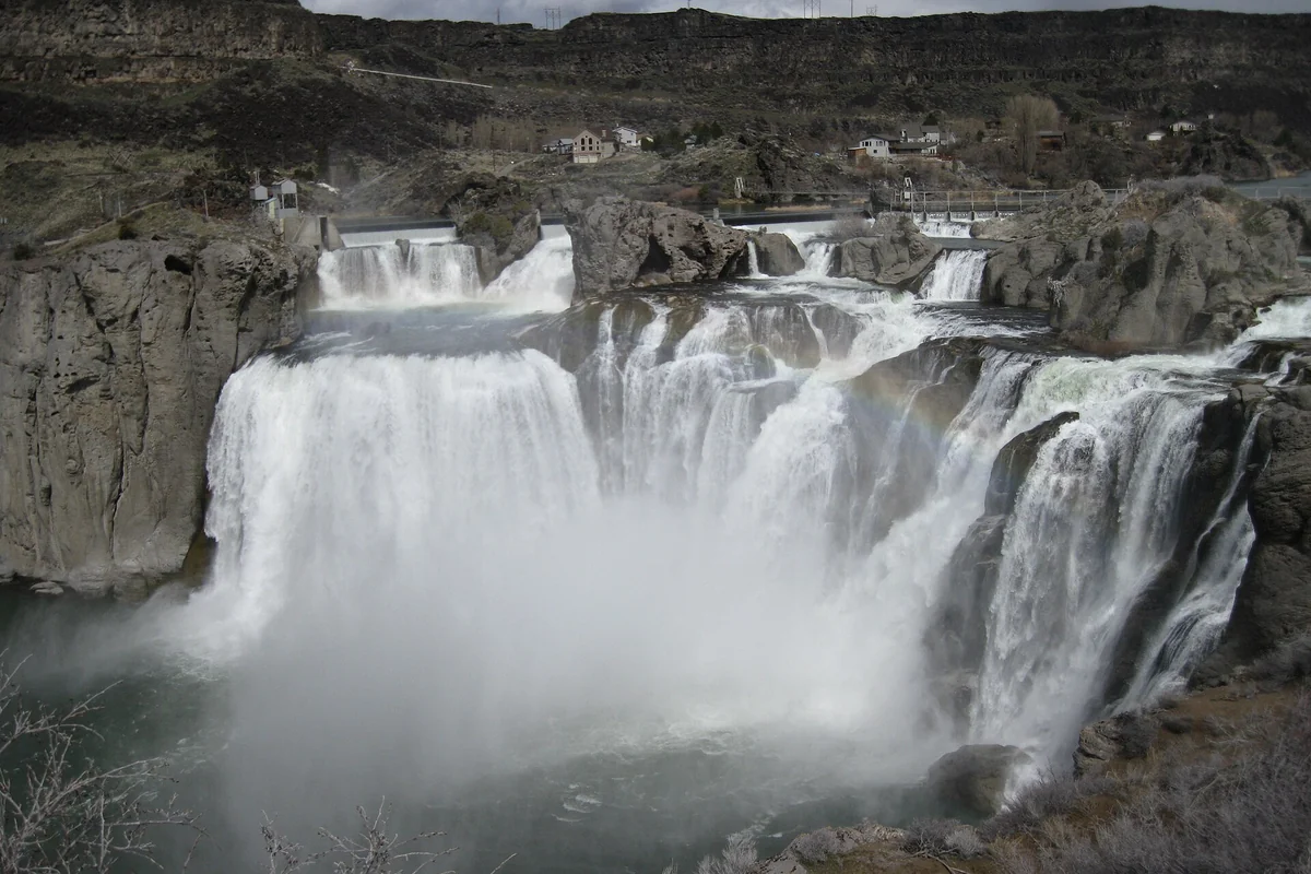
Shoshone Falls is a major attraction, but the scene is not identical throughout the year. Visit Southern Idaho recommends spring for stronger flows; irrigation demands and river conditions affect the waterfall later in the season. A photograph of a broad wall of water is not a promise of the flow you will see on your date.
Stay behind barriers and use designated overlooks. Reaching a canyon-floor launch point is a different undertaking from visiting a rim overlook, so do not assume every attraction labeled “Snake River Canyon” shares the same road access.
Thousand Springs and Hagerman: make a separate day of it
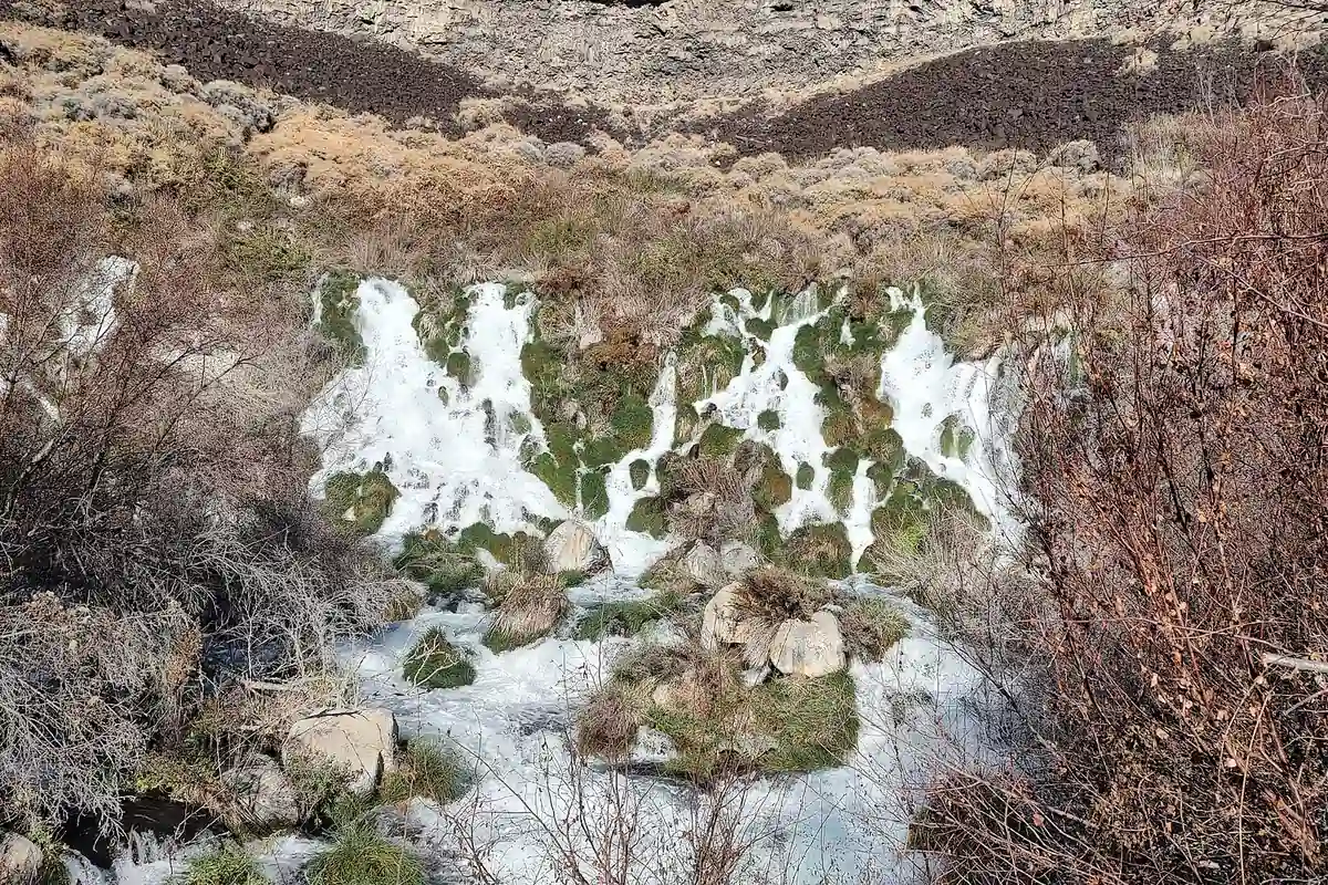
The Thousand Springs Scenic Byway follows US-30 between Bliss and the Twin Falls area, passing through a landscape shaped by aquifer water and the Snake River. This is the scenic-road choice when your aim is to stop and look rather than simply move along I-84. Do not schedule it as though it were a nonstop freeway transfer.
Thousand Springs State Park consists of separate units, not one entrance where every spring and trail is immediately accessible. Choose a specific unit such as Malad Gorge, Ritter Island or Box Canyon, then check that unit’s road, season and access information. One park name on a map can conceal several distinct outings.
Nearby Hagerman Fossil Beds National Monument adds a different layer: the story of ancient environments and fossil discoveries, rather than a place to hunt for a souvenir fossil. Use the National Park Service’s current visitor information to plan the educational component. Public fossil collecting is not the purpose of a national monument visit.
City of Rocks: granite country near Almo
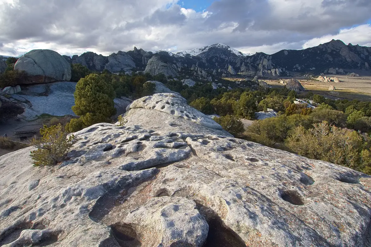
City of Rocks National Reserve, near Almo, trades the broad river plain for granite formations, trails, climbing and California Trail history. It deserves its own day or overnight plan. Nonclimbers can still enjoy the landscape, but should choose a mapped walk rather than follow climbers onto technical terrain.
The National Park Service notes that the reserve is open year-round, while winter weather and road conditions can prevent access to portions of it. The visitor center in Almo serves both City of Rocks and nearby Castle Rocks State Park; its seasonal hours are separate from the reserve’s general access. Check both the road report and the visitor-center schedule if you need ranger advice or printed maps.
Craters of the Moon: a different route across the plain
Craters of the Moon National Monument and Preserve belongs on a route that allows time for lava landscapes rather than as a rushed add-on to every Twin Falls stay. The National Park Service describes most sightseeing as concentrated along the Loop Road, with trails and viewpoints revealing the volcanic terrain.
Summer sun and exposed lava make water and sun protection important. Winter changes the visit substantially: vehicle access to the Loop Road is seasonal, and snow can linger into spring. Cave access has its own rules and current restrictions, so check the NPS conditions page before planning the entire visit around going underground.
Leave time for Minidoka’s history
Minidoka National Historic Site commemorates the incarceration of Japanese Americans during World War II. It is not simply another scenery stop. Allow time to read the interpretation and consider the people whose lives were disrupted by forced removal and confinement.
Check the site’s current visitor information before arranging a visit around indoor exhibits or ranger services. Even on a landscape-heavy road trip, this historical context gives southern Idaho a depth that a waterfall-only itinerary misses.
A realistic first-trip framework
With two full days, use one for Twin Falls and its canyon viewpoints, and the other for selected Thousand Springs and Hagerman stops. With a third day, choose either City of Rocks or a route toward Craters of the Moon based on your next destination. Add Minidoka where its location and opening arrangements fit, without reducing it to a hurried photo break.
Check Idaho 511 before driving, especially in winter, and verify park conditions before leaving reliable service. Keep water and fuel margins, use public access points, and do not cross farm ground because a waterfall appears close on a satellite map. Southern Idaho works best when the itinerary follows actual access roads and seasonal conditions rather than the apparent proximity of map pins.
Questions before you go
Where should you stay for a first southern Idaho trip?
Twin Falls is a practical base for Snake River Canyon and nearby waterfall outings. Choose a different base or overnight stop if City of Rocks or Craters of the Moon is the main purpose of your trip.
When is the best time to see Shoshone Falls?
Regional tourism guidance recommends spring for stronger flows. Water levels vary with runoff, irrigation and river management, so check current conditions rather than relying on a photo.
Can you visit southern Idaho in winter?
Yes, but adapt the itinerary to weather and access. Portions of City of Rocks may be difficult to reach, and Craters of the Moon’s Loop Road closes to vehicles seasonally.
Sources & planning resources
- Visit Southern Idaho: Thousand Springs Scenic Byway
- Visit Southern Idaho: top regional attractions
- Idaho Parks and Recreation: Thousand Springs State Park
- National Park Service: City of Rocks hours and seasons
- National Park Service: Craters of the Moon basic information
- National Park Service: Hagerman Fossil Beds
- National Park Service: Minidoka
- Idaho Transportation Department: road conditions